Bacalar at a Glance
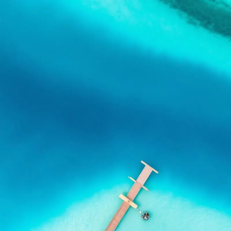
Bacalar is a freshwater lagoon roughly 42 km long in southern Quintana Roo, famous for water that shifts through at least seven distinguishable shades of blue. The effect comes from a white limestone bottom, varying depths and cenotes that open in the lagoon floor.
The town itself is small, walkable and designated a Pueblo Magico. Life revolves around the water: kayaking at sunrise, sailing in the afternoon and swimming from wooden docks.
It sits far enough south that mass tourism has not arrived. Most travellers come from Tulum, four hours north, or from Chetumal near the Belize border.
The History of Bacalar
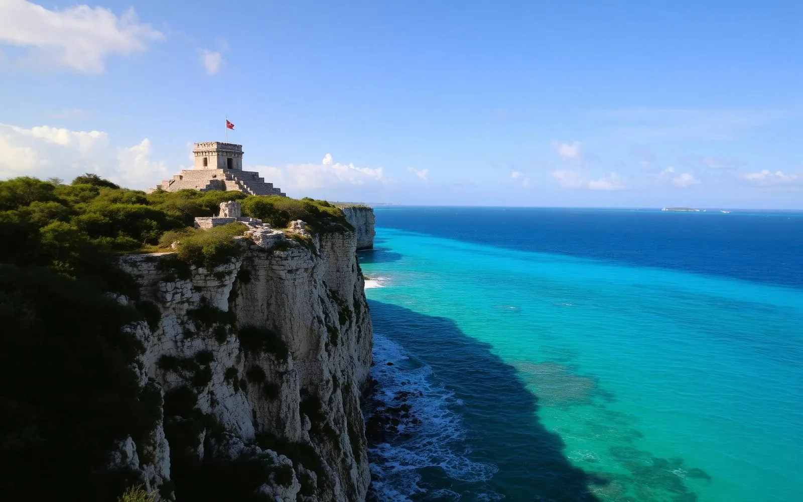
Bacalar was the Maya settlement of Bakhalal, meaning 'surrounded by reeds', and was one of the earliest areas of the region contacted by the Spanish.
The Fuerte de San Felipe was built in 1729 to defend the town against English pirates who came up the Rio Hondo from the Caribbean to raid logwood shipments.
During the 19th-century Caste War, Bacalar changed hands repeatedly between Maya forces and the Mexican government, and the fort still bears the marks of that period.
Where Is Bacalar?
Bacalar lies in southern Quintana Roo, about 40 km north of Chetumal and roughly 230 km south of Tulum.
Cancun International Airport is around 320 km north, a drive of four and a half to five hours; Chetumal has the closest airport.
The lagoon runs parallel to the coast, separated from the Caribbean by a strip of low jungle.
Why Visit Bacalar
The lagoon itself
There is nothing else quite like it in Mexico: freshwater, warm, shallow and spectacularly coloured.
Stromatolites
Living microbial reefs among the oldest known life forms on Earth, growing along the shoreline.
Cenotes inside a lagoon
Cenote Negro, Cenote Esmeralda and others open as deep blue holes in the lagoon floor.
A slow, uncommercial town
No resorts, no crowds, no cruise ships.
Colonial and Caste War history
The San Felipe fort and its museum give real historical depth to the visit.
Things to Do in Bacalar
Sail or kayak the lagoon
Early morning is calmest and best for colour; sailing catamarans run afternoon trips.
Visit the Fuerte de San Felipe
A restored 18th-century fort with a museum on piracy and the Caste War.
Swim at Los Rapidos
A narrow channel with gentle current and extensive stromatolite formations.
See Cenote Azul
A 90-metre-deep cenote just south of town, separate from the lagoon.
Walk the Costera
The lakefront road with public docks, viewpoints and small restaurants.
Visit Cenote Cocalitos
Shallow water, swings over the lagoon and one of the easiest places to see stromatolites.
Best Beaches in Bacalar
Balneario Ejidal
The main public swimming area with docks, shade and shallow entry.
Cenote Cocalitos
A lagoon-front spot with hammocks over the water and stromatolite shallows.
Los Rapidos
A channel with mild current where you can float downstream.
Public docks along the Costera
Free access points into the lagoon used mostly by residents.
Note
Bacalar has no sea beaches — all swimming is freshwater lagoon or cenote.
Cenotes Near Bacalar
Cenote Azul
One of Mexico's deepest cenotes at around 90 metres, with a restaurant and dock access.
Cenote Negro (La Bruja)
A dark, deep hole in the lagoon floor reached by boat.
Cenote Esmeralda
A green-toned cenote inside the lagoon, a standard stop on boat tours.
Cenote Cocalitos
Shallow lagoon-edge cenote surrounded by stromatolites.
Cenote Grande
The largest of the lagoon's submerged cenotes.
Nature and Landscapes
- The stromatolites of Bacalar are among the largest freshwater colonies in the world and are extremely fragile.
- The lagoon is fed by underground rivers and cenotes rather than surface rivers.
- Surrounding wetlands and jungle support crocodiles, herons, egrets and abundant dragonfly populations.
- Water quality has come under pressure from development, and local conservation groups actively monitor the lagoon.


Marine Life
Stromatolites
Living microbial structures, biologically the lagoon's most significant feature.
Freshwater fish
Mojarras, tetras and catfish inhabit the shallows.
Morelet's crocodile
Present in the quieter reed edges of the lagoon; not a threat if left alone.
Birdlife
Herons, cormorants, kingfishers and migratory waders along the shore.
Culture and Traditions
- Bacalar's Pueblo Magico status recognises its colonial architecture and historical significance.
- The town's identity mixes Maya, Caribbean and Mexican influences, with proximity to Belize adding another layer.
- Local markets sell honey, spices and crafts from surrounding Maya communities.
- The annual fair and Day of the Dead celebrations are the main community events.
Local Gastronomy
Freshwater fish
Locally caught mojarra, fried whole and served with rice and salad.
Relleno negro
A dark, deeply spiced turkey stew from the Yucatan tradition.
Belizean influences
Rice and beans cooked with coconut milk appear on menus close to the border.
Tacos and panuchos
Standard Yucatecan street food around the plaza.
Local honey and chocolate
Produced by nearby cooperatives and sold in the town centre.
Weather in Bacalar
- Warm and humid year-round, averaging 26–28 °C, with lagoon water comfortable in every season.
- The dry season runs November to April with the best colour and calmest water.
- Rain from June to October can cloud the lagoon and reduce the intensity of the blues.
- Mornings are almost always still; wind rises through the afternoon.
- Mosquitoes are most active at dusk near the reeds.
Best Time to Visit Bacalar
November to April
Clearest water, strongest colours and mildest weather.
May to June
Warm and quiet before the rains, with good prices.
Early morning
The lagoon is mirror-flat and at its most photogenic before 9am.
How to Get to Bacalar
From Cancun International Airport
About 320 km, roughly four and a half to five hours by road.
From Tulum
Around 230 km, or two and a half to three hours.
From Chetumal
About 40 km, or 40 minutes — the closest airport.
Getting around
The town is walkable; boats and kayaks cover the lagoon.
Travel Tips
- Do not use sunscreen or repellent before entering the lagoon — both damage the stromatolites.
- Choose small boat operators using electric or sail power where possible.
- Stay overnight rather than day-tripping; Bacalar's appeal is its pace.
- Bring cash — card acceptance is inconsistent outside larger hotels.
- Combine Bacalar with Mahahual or the Costa Maya if travelling further south.
Safety Tips
- Never walk on or touch the stromatolites; they take decades to grow and break underfoot.
- Watch for boat traffic when swimming away from designated docks.
- Crocodiles inhabit reed edges — swim in open, established areas.
- The Tulum–Bacalar highway is best driven in daylight due to unlit stretches and speed bumps.
- Use repellent in the evenings away from the water.
Interesting Facts About Bacalar
- Bacalar's lagoon is often called the Lagoon of Seven Colors for its distinct bands of blue.
- Stromatolites are among the oldest known life forms, dating back over three billion years.
- Cenote Azul is one of the deepest cenotes in Mexico at around 90 metres.
- The Fuerte de San Felipe was built specifically to repel pirate raids.
- Bakhalal, the Maya name, means 'surrounded by reeds'.